
How Flight Tracking Works: ADS-B, MLAT and Satellites
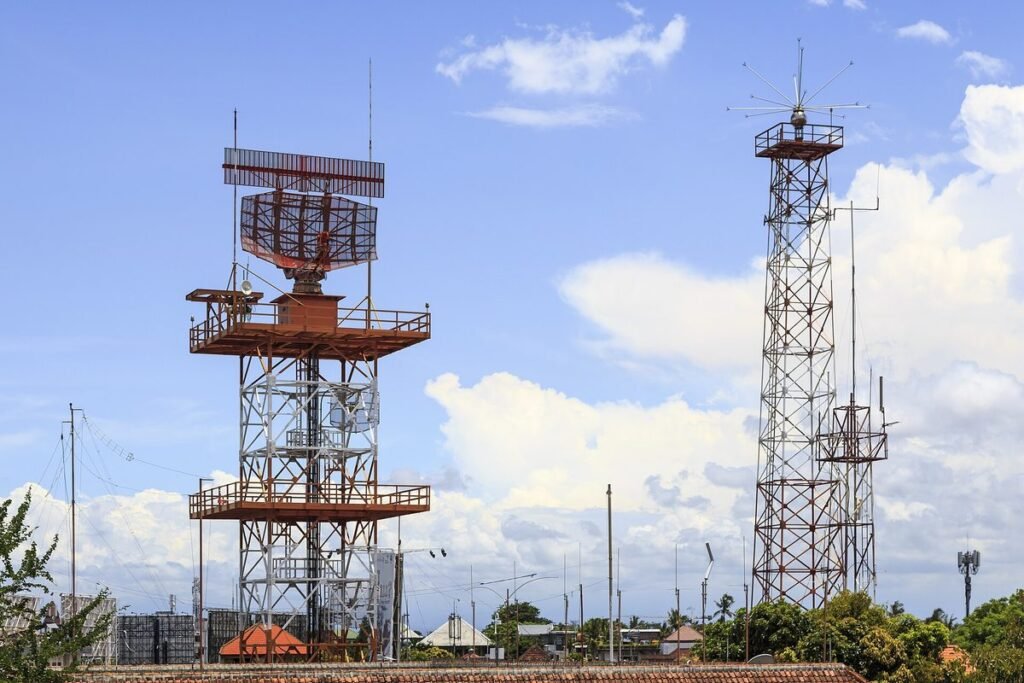

How does flight tracking work? Most aircraft broadcast their own GPS position about once a second over a system called ADS-B, volunteer receivers on the ground pick up those messages, and tracking networks merge them into one live map. Where there are no receivers, multilateration, satellites and flight plan estimates fill the holes.
ADS-B Out: the airplane announces itself
ADS-B stands for Automatic Dependent Surveillance–Broadcast. “Automatic” because the pilot does nothing; “dependent” because the position comes from the aircraft’s own GPS rather than from a radar measuring it. Each message carries:
- a 24-bit ICAO address, a unique hex code tied to the registration (an N-number maps to exactly one code);
- latitude and longitude;
- pressure altitude and often GPS altitude;
- ground speed, track and vertical rate;
- call sign and squawk code;
- integrity and accuracy values that tell controllers how much to trust the position.
In the United States, ADS-B Out runs on two frequencies. Airliners and anything flying at or above 18,000 feet use 1090 MHz Extended Squitter, the international standard. Many light aircraft flying lower use UAT on 978 MHz, a US-only link. The free consumer receivers most hobbyists build listen on 1090 MHz, which is why a Cessna with a UAT box can be invisible to a basic home station while an airliner 200 miles away shows up fine.
The FAA mandate of January 1, 2020
Since January 1, 2020, 14 CFR 91.225 requires ADS-B Out in most controlled airspace that matters to traffic:
- Class A, B and C airspace;
- within 30 nautical miles of the primary airports of Class B airspace (the “Mode C veil”), from the surface up to 10,000 feet MSL;
- Class E at and above 10,000 feet MSL over the 48 contiguous states and DC, excluding airspace at and below 2,500 feet AGL;
- Class E over the Gulf of Mexico at and above 3,000 feet MSL within 12 nautical miles of the US coast.
Outside those volumes, an airplane can still fly legally without ADS-B. A J-3 Cub with no electrical system hopping between grass strips in rural Class G airspace never needs it, and it will never show up on flight tracking apps unless it carries a portable unit.
The mandate also gave pilots something back. Aircraft with ADS-B In, or a portable receiver paired with an EFB such as ForeFlight on an iPad, get free traffic and weather in the cockpit through the FAA’s TIS-B and FIS-B services. That free weather is a big reason so many owners equipped with UAT.
Ground receivers and the line-of-sight limit
VHF and UHF signals travel in straight lines, so a receiver hears an aircraft only above its horizon. A handy rule of thumb puts the radio horizon in nautical miles at about 1.23 times the square root of the height in feet. Run the numbers:
- Airliner at 36,000 feet: 1.23 × 190 ≈ 230 nautical miles.
- Cessna at 2,500 feet: 1.23 × 50 ≈ 60 nautical miles, before you add the receiver’s own height.
- Helicopter at 500 feet over a city: roughly 27 nautical miles, often less behind buildings and hills.
That is why coverage of airliners at cruise looks nearly perfect over land while low-level traffic in valleys flickers. Both Flightradar24 and FlightAware advertise networks of tens of thousands of receivers, and most of them are hobbyists’ boxes with an antenna in an attic or on a chimney.
MLAT: tracking aircraft that don’t broadcast position
Older Mode S transponders reply to radar and send short messages with altitude and identity, but no position. Multilateration, or MLAT, works around that. When four or more receivers with GPS-synchronized clocks catch the same message, the tiny differences in arrival time let a server compute where the aircraft must be. It is the same geometry as GPS, run backward.
MLAT has limits. It needs several receivers in view at once, so it fails at low altitude in sparse areas, and its positions are less precise and refresh more slowly than ADS-B. Trackers usually mark MLAT targets with a different label or color in the aircraft panel.
Satellites over oceans and poles
Ground receivers stop at the coastline. Over the North Atlantic, the Pacific or Siberia, the gap is filled by space-based ADS-B. The main provider, Aireon, puts 1090 MHz receivers on the Iridium NEXT satellite constellation and has run worldwide coverage since 2019. Air navigation service providers buy that data to separate traffic over oceans; trackers resell a slice of it to subscribers or show it on their paid layers.
When no live data exists at all, the map shows an estimated position calculated from the flight plan and the last known speed. On FlightAware and Flightradar24, those estimates are labeled as such, and the icon snaps back to a real position once the aircraft reaches receiver coverage again.
Why some planes don’t show: LADD, PIA and the military
A blank spot where you expect a jet is rarely a technical glitch. Four causes cover almost every case:
- LADD. The FAA’s Limiting Aircraft Data Displayed program lets owners ask that their aircraft be filtered from the FAA data feeds that commercial trackers receive. The big trackers also honor those blocks on their own receiver data.
- PIA. The Privacy ICAO Address program assigns a temporary 24-bit address that is not linked to the registration in public records. Eligible aircraft must be US-registered, equipped with 1090 MHz ADS-B, use a third-party call sign and fly in US-managed airspace. Owners can request a new address after 20 days, and the FAA Reauthorization Act of 2024 shields the link between a PIA and its aircraft from FOIA requests.
- Military and government flights often switch ADS-B off or broadcast without a call sign, though many transports and tankers leave it on.
- No equipment, no coverage. Light aircraft outside rule airspace, or low traffic far from receivers.
Sites that refuse to filter, ADS-B Exchange being the best known, still show LADD aircraft because they never apply the block. A PIA aircraft appears there too, but under an anonymous hex code with no registration attached.
Build your own feeder with a Raspberry Pi
A home receiver is a cheap weekend project and earns free premium accounts on the big networks. A typical shopping list:
- A Raspberry Pi: a 1 GB Pi 4 lists at $35 and a 1 GB Pi 5 at $45 after the 2026 memory-driven price increases on larger models. An older Pi 3 works fine.
- A USB ADS-B dongle with a 1090 MHz filter and amplifier, such as FlightAware’s Pro Stick Plus.
- A 1090 MHz antenna and a short, good-quality coax cable.
- A microSD card, a power supply and an Ethernet cable or Wi-Fi.
Expect roughly $100 to $150 all in. Flash the PiAware or Pi24 image to the card, register the device with the network, and your receiver starts sending data within minutes. You can add other networks’ feeder packages to the same Pi later.
I have watched more than one friend spend money on a fancier dongle when the real problem was an antenna sitting behind a brick wall. Placement does most of the work: as high as possible, with a clear view of the horizon in the direction of the nearest airport, and the shortest cable you can manage, because coax loses a lot of signal at 1090 MHz.
Once the box is running, you will see what your own corner of the sky really looks like. I still find it satisfying to watch my receiver pick up a jet over the next state before it shows on any phone in the room.
Related reading: How to Listen to Air Traffic Control Online · How to Become a Flight Attendant: Requirements and Pay
FAQ
Can flight trackers see every plane?
No. They see aircraft broadcasting ADS-B or Mode S within range of a receiver, plus satellite and estimated positions. Aircraft without transponders, flights hidden through FAA privacy programs and some military flights stay off most maps.
Is ADS-B required for all aircraft in the US?
Only in the airspace listed in 14 CFR 91.225, including Class A, B and C, the Mode C veil and Class E above 10,000 feet MSL. Aircraft that stay outside those areas, such as many light planes in Class G, may fly without it.
How do flight trackers track planes over the ocean?
Mostly through space-based ADS-B. Aireon's receivers aboard Iridium satellites pick up 1090 MHz broadcasts anywhere on Earth. When no live signal exists, trackers display an estimated position built from the flight plan.
How far can an ADS-B receiver pick up planes?
Range depends on the aircraft's altitude and the antenna's view of the horizon. A well-placed home setup commonly hears airliners at cruise 150 to 250 nautical miles away, but low-flying aircraft only within a few dozen miles.
Keep exploring
- Flight TrackingFlightradar24 vs FlightAware: Which Tracker Fits You?
- Flight TrackingBest Flight Tracking Websites and Apps in 2026
- Flight TrackingHow to Listen to Air Traffic Control Online
- Air TravelBest Websites for Finding Cheap Flights
- Aviation CareersHow to Become a Flight Attendant: Requirements and Pay
- Aviation News & MediaBest Aviation Podcasts for Pilots and Fans
- Flight SimulatorsFree Flight Simulators You Can Fly Today